St Mary's Church, Morcott seen from School Lane
Introduction
The photograph on this page of St Mary's Church, Morcott seen from School Lane by Marathon as part of the Geograph project.
The Geograph project started in 2005 with the aim of publishing, organising and preserving representative images for every square kilometre of Great Britain, Ireland and the Isle of Man.

There are currently over 7.5m images from over 14,400 individuals and you can help contribute to the project by visiting https://www.geograph.org.uk
St Mary's Church, Morcott seen from School Lane
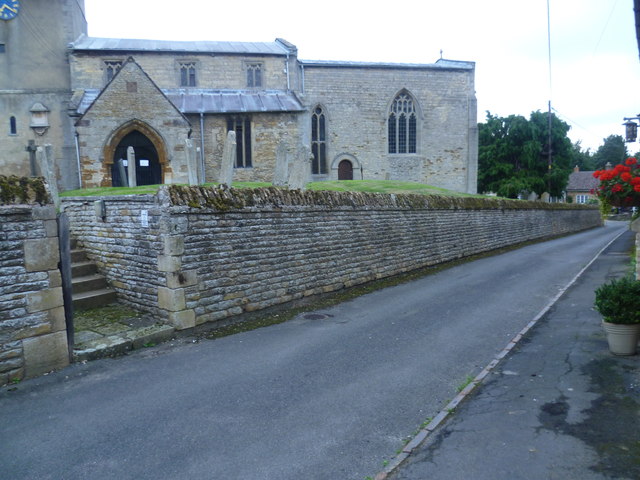
Image: © Marathon Taken: 17 Aug 2013
Morcott means 'moor village'. St Mary's Church is the most complete Norman church in Rutland. It originally had a small nave and chancel and west tower. The north aisle was seed in about 1150 and the south aisle seen here was added in about 1200.
Images are licensed for reuse under creativecommons.org/licenses/by-sa/2.0
Image Location
Latitude
52.596866
Longitude
-0.636242