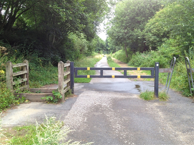
Traffic control, Trans Pennine Trail
Introduction
The photograph on this page of Traffic control, Trans Pennine Trail by Robin Stott as part of the Geograph project.
The Geograph project started in 2005 with the aim of publishing, organising and preserving representative images for every square kilometre of Great Britain, Ireland and the Isle of Man.
There are currently over 7.5m images from over 14,400 individuals and you can help contribute to the project by visiting https://www.geograph.org.uk

Image: © Robin Stott Taken: 17 Aug 2013
Allowing intended users free access to a trail while blocking unwanted users can be quite involved and needs to be of robust construction. Here, walkers, joggers, bikes, pushchairs and (possibly) wheelchairs can pass unimpeded on the right. The arrangement on the left allows horses to step through while preventing all but the most determined motorcyclist. The locked central barrier is for maintenance and emergency vehicles only. The Knott Fold bridge is behind the camera. For a winter view and more information see Image

