Library Walk
Introduction
The photograph on this page of Library Walk by Gerald England as part of the Geograph project.
The Geograph project started in 2005 with the aim of publishing, organising and preserving representative images for every square kilometre of Great Britain, Ireland and the Isle of Man.

There are currently over 7.5m images from over 14,400 individuals and you can help contribute to the project by visiting https://www.geograph.org.uk
Library Walk
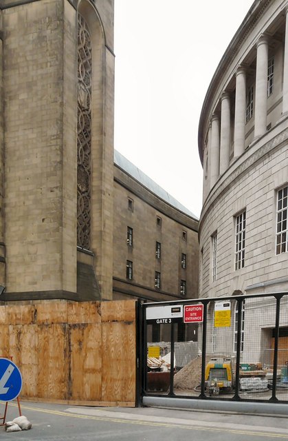
Image: © Gerald England Taken: 14 Aug 2013
Viewed from Mount Street Image On the right is the rear of Manchester Central Library. On the left is the Extension to Manchester Town Hall http://en.wikipedia.org/wiki/Manchester_Town_Hall_Extension Both are currently undergoing extensive renovation. A footpath known as Library Walk curves between the two buildings, but presently there is no public access due to the continuing building work.
Images are licensed for reuse under creativecommons.org/licenses/by-sa/2.0
Image Location
Latitude
53.478383
Longitude
-2.245109