Isis Lock, Oxford
Introduction
The photograph on this page of Isis Lock, Oxford by David Hallam-Jones as part of the Geograph project.
The Geograph project started in 2005 with the aim of publishing, organising and preserving representative images for every square kilometre of Great Britain, Ireland and the Isle of Man.

There are currently over 7.5m images from over 14,400 individuals and you can help contribute to the project by visiting https://www.geograph.org.uk
Isis Lock, Oxford
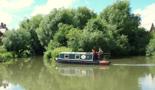
Image: © David Hallam-Jones Taken: 29 Jul 2013
Having come through Isis Lock (a.k.a. Louse Lock) from a northerly direction towards Oxford, boat-users wishing to travel further ahead are obliged to turn to their right here and to travel north-westwards via the River Thames. By doing so, they will then travel parallel with the Oxford Canal for several miles until the two routes split from their parallel state and this user will unavoidably begin to veer towards Godstow Lock. No further progress toward the city, i.e. towards the photographer, is possible because of a barrier of linked floating buoys. The houses in amongst the trees are situated in Rewley Road, a road that curls around the left hand bank.
Images are licensed for reuse under creativecommons.org/licenses/by-sa/2.0
Image Location
Latitude
51.755547
Longitude
-1.269208