Stoke Golding: Station Road hosiery factory
Introduction
The photograph on this page of Stoke Golding: Station Road hosiery factory by Nigel Cox as part of the Geograph project.
The Geograph project started in 2005 with the aim of publishing, organising and preserving representative images for every square kilometre of Great Britain, Ireland and the Isle of Man.

There are currently over 7.5m images from over 14,400 individuals and you can help contribute to the project by visiting https://www.geograph.org.uk
Stoke Golding: Station Road hosiery factory
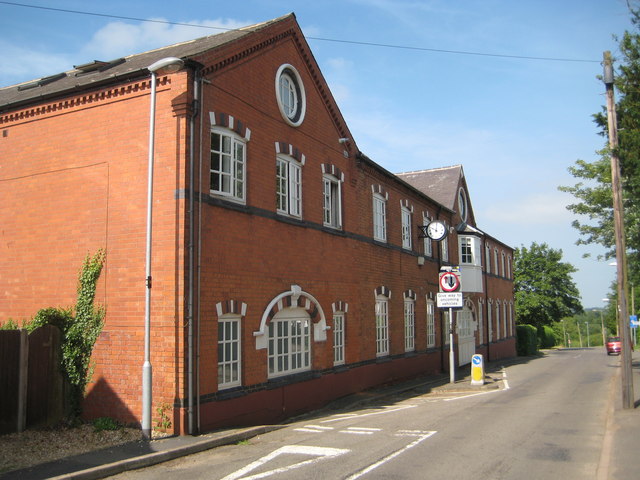
Image: © Nigel Cox Taken: 11 Jul 2013
The old Ordnance Survey map of 1888 shows a hosiery factory on this site, although the current building is distinctly Edwardian in design and much larger than its Victorian counterpart.
Images are licensed for reuse under creativecommons.org/licenses/by-sa/2.0
Image Location
Latitude
52.570838
Longitude
-1.419069