View from Grain Crossing towards the site of Grain Crossing Halt
Introduction
The photograph on this page of View from Grain Crossing towards the site of Grain Crossing Halt by Marathon as part of the Geograph project.
The Geograph project started in 2005 with the aim of publishing, organising and preserving representative images for every square kilometre of Great Britain, Ireland and the Isle of Man.

There are currently over 7.5m images from over 14,400 individuals and you can help contribute to the project by visiting https://www.geograph.org.uk
View from Grain Crossing towards the site of Grain Crossing Halt
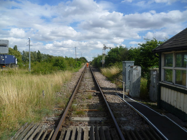
Image: © Marathon Taken: 15 Aug 2013
The line across the Hoo Peninsula is single track and one of the most interesting lines in Kent. Passenger trains ran on this line from 1882 to 1961, which seems surprising now as it doesn't really serve any significant centres of population. It is still in use by regular container trains on their way via Hoo Junction to and from Thamesport on the Isle of Grain. A train heading west over the level crossing can be seen at http://www.geograph.org.uk/photo/3603260 On the left side of the track ahead is the site of Grain Crossing Halt which was opened by the South Eastern & Chatham Railway in July 1906 and closed on 11th July 1951 during the expansion of the nearby oil terminal. See http://www.disused-stations.org.uk/g/grain_crossing_halt/ for more information on Grain Crossing Halt. This is the view towards Thamesport. The man walking ahead has just closed and opened the crossing gates for a Network Rail ballast train to pass.
Images are licensed for reuse under creativecommons.org/licenses/by-sa/2.0
Image Location
Latitude
51.445479
Longitude
0.680504