Footpath past Welby Hill Top Farm
Introduction
The photograph on this page of Footpath past Welby Hill Top Farm by Alan Murray-Rust as part of the Geograph project.
The Geograph project started in 2005 with the aim of publishing, organising and preserving representative images for every square kilometre of Great Britain, Ireland and the Isle of Man.

There are currently over 7.5m images from over 14,400 individuals and you can help contribute to the project by visiting https://www.geograph.org.uk
Footpath past Welby Hill Top Farm
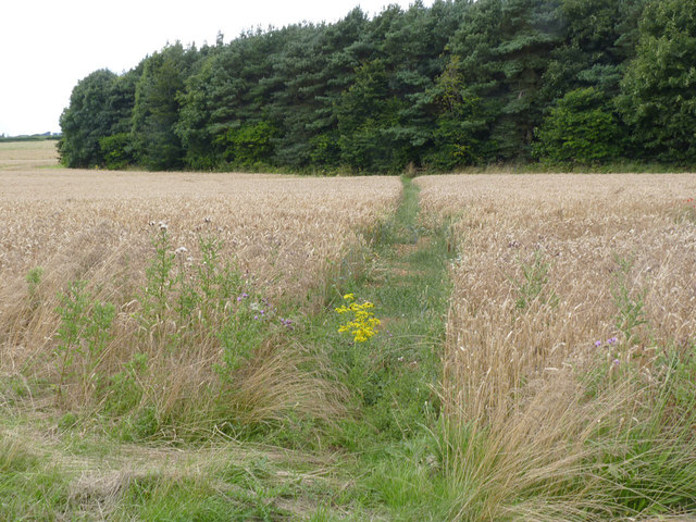
Image: © Alan Murray-Rust Taken: 11 Aug 2013
The path was established after the cessation of ironstone quarrying, and presumably before the plantation was formed, as it runs in a straight line through the plantation and beyond. This was the site of the Harlaxton Quarries No.2 or Welby quarry, worked between 1943 and 1965.
Images are licensed for reuse under creativecommons.org/licenses/by-sa/2.0
Image Location
Latitude
52.867709
Longitude
-0.697291