Hassobury
Introduction
The photograph on this page of Hassobury by David Beresford as part of the Geograph project.
The Geograph project started in 2005 with the aim of publishing, organising and preserving representative images for every square kilometre of Great Britain, Ireland and the Isle of Man.

There are currently over 7.5m images from over 14,400 individuals and you can help contribute to the project by visiting https://www.geograph.org.uk
Hassobury
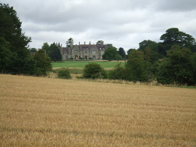
Image: © David Beresford Taken: 15 Aug 2013
The Hassobury Estate is mentioned in the Domesday Book. The mansion was rebuilt in 1868. For some time in the last century it became Waterside Prep School but this closed in the 1980's.
Images are licensed for reuse under creativecommons.org/licenses/by-sa/2.0
Image Location
Latitude
51.90455
Longitude
0.157919