Matfield House & stables
Introduction
The photograph on this page of Matfield House & stables by David Kemp as part of the Geograph project.
The Geograph project started in 2005 with the aim of publishing, organising and preserving representative images for every square kilometre of Great Britain, Ireland and the Isle of Man.

There are currently over 7.5m images from over 14,400 individuals and you can help contribute to the project by visiting https://www.geograph.org.uk
Matfield House & stables
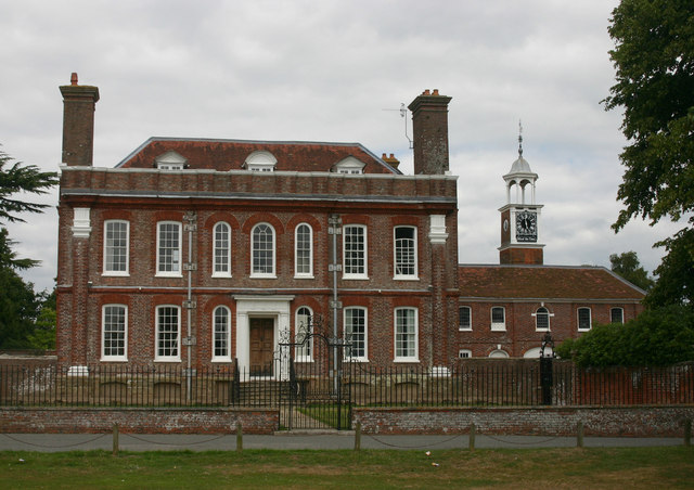
Image: © David Kemp Taken: 14 Aug 2013
Matfield House dates from 1728. Pevsner regards the turret on the stables as "charming" but "very much too large".
Images are licensed for reuse under creativecommons.org/licenses/by-sa/2.0
Image Location


Leaflet Map data © OpenStreetMap
Latitude
51.152516
Longitude
0.369607