Iffley, Oxford
Introduction
The photograph on this page of Iffley, Oxford by David Hallam-Jones as part of the Geograph project.
The Geograph project started in 2005 with the aim of publishing, organising and preserving representative images for every square kilometre of Great Britain, Ireland and the Isle of Man.

There are currently over 7.5m images from over 14,400 individuals and you can help contribute to the project by visiting https://www.geograph.org.uk
Iffley, Oxford
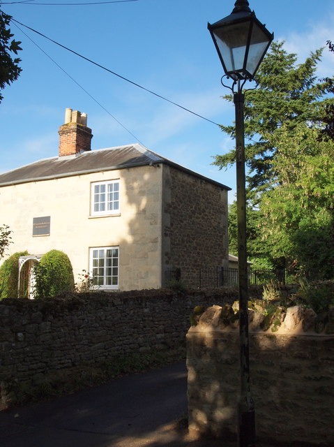
Image: © David Hallam-Jones Taken: 30 Jul 2013
This track is off Church Way and runs long the eastern side of the former location of Miss Sarah Nowell's School, now a private residence. In her Will Miss Nowell left funding and instructions for the creation of a trust that would bear her name and that would provide for the education of eight poor girls and two poor boys from the village. It was actually The Alice Smith Charity who established the school in 1805 in the schoolmistress's own home until this purpose-built school was opened in 1822. The Church and Parish Hall lie a few paces to the right and the commercial centre of the village, i.e. two pubs and a community-run shop, are the 2-3 minutes walk to the left.
Images are licensed for reuse under creativecommons.org/licenses/by-sa/2.0
Image Location
Latitude
51.728554
Longitude
-1.237789