Croxley Rail Link (6): Former Watford West station
Introduction
The photograph on this page of Croxley Rail Link (6): Former Watford West station by Nigel Cox as part of the Geograph project.
The Geograph project started in 2005 with the aim of publishing, organising and preserving representative images for every square kilometre of Great Britain, Ireland and the Isle of Man.

There are currently over 7.5m images from over 14,400 individuals and you can help contribute to the project by visiting https://www.geograph.org.uk
Croxley Rail Link (6): Former Watford West station
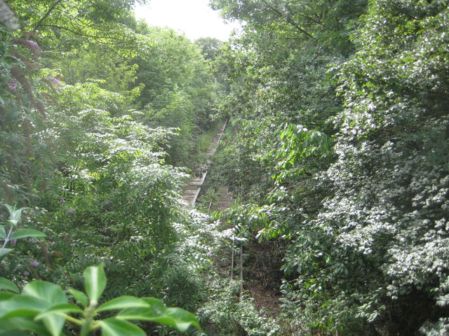
Image: © Nigel Cox Taken: 4 Aug 2013
In July 2013 The Secretary of State for Transport issued a Transport and Works Act Order for the proposed Croxley Rail Link scheme granting the planning permissions, access rights and land transfers necessary for the scheme to go ahead. The £118m scheme proposes that the current London Underground Metropolitan Line branch to Watford would be re-routed from a point east of Croxley station and extended to Watford Junction station via Watford High Street station, with the closure of the original Watford station to passenger traffic. It is proposed that new stations would be provided on the new rail link at Ascot Road, where a park and ride facility would be provided, and at Vicarage Road, in order to serve Watford General Hospital, the proposed Watford Health Campus development, and Watford Football Club. Construction work is scheduled to commence in 2014 with completion planned for 2016. The Croxley Rail Link's website is here http://www.croxleyraillink.com/Default.htm This is the former Watford West station, dating from 1912 and the opening of the L&NWR's Croxley Branch. The new line would utilize the trackbed through here, but it is not planned to re-open the old station. Despite the summer vegetation it can be seen that the track and the platform of the former station are still extant. This is the view from the Tolpits Lane bridge. This view has been taken in:- September 1985 Image April 2005 Image March 2008 Image March 2013 Image
Images are licensed for reuse under creativecommons.org/licenses/by-sa/2.0
Image Location
Latitude
51.64839
Longitude
-0.414107