Old Burgh Hall: detail
Introduction
The photograph on this page of Old Burgh Hall: detail by Lairich Rig as part of the Geograph project.
The Geograph project started in 2005 with the aim of publishing, organising and preserving representative images for every square kilometre of Great Britain, Ireland and the Isle of Man.

There are currently over 7.5m images from over 14,400 individuals and you can help contribute to the project by visiting https://www.geograph.org.uk
Old Burgh Hall: detail
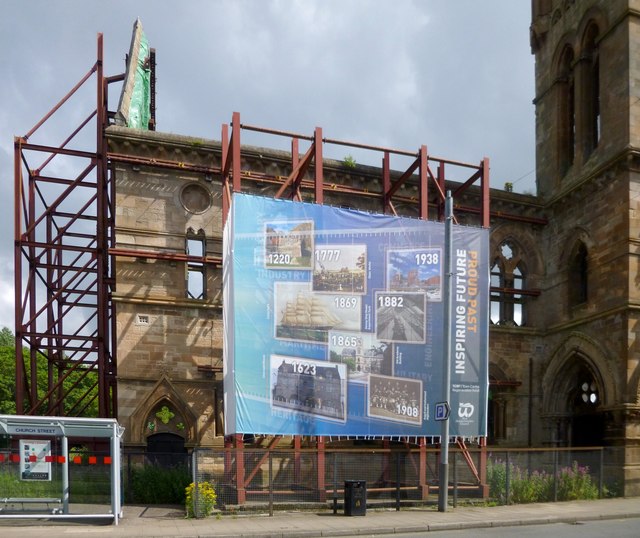
Image: © Lairich Rig Taken: 26 Jul 2013
Ordered by date, the panels on this recently-installed banner are as follows (I have added some links with further information); note that the "Old Academy Building" is another name for the Old Burgh Hall, the building shown in the present photograph: 1220: Dumbarton Castle – http://www.geograph.org.uk/article/Dumbarton-Rock-and-Castle 1623: Glencairn House – http://www.geograph.org.uk/snippet/276 1777: Glass Works – http://www.geograph.org.uk/photo/930603 1865: Old Academy Building – http://www.geograph.org.uk/photo/2033511 1869: Cutty Sark 1882: Denny Ship Model Experimental Tank – http://www.geograph.org.uk/photo/1135975 1908: Argyll and Sutherland Highlanders 1938: Ballantine's Whisky Distillery – http://www.geograph.org.uk/photo/1442360 This banner, on the northern wing of the building, is one of a pair; for the one on the southern wing, see Image
Images are licensed for reuse under creativecommons.org/licenses/by-sa/2.0
Image Location
Latitude
55.943768
Longitude
-4.56737