
The Collingwood Arms, Brandling Village
Introduction
The photograph on this page of The Collingwood Arms, Brandling Village by Andrew Curtis as part of the Geograph project.
The Geograph project started in 2005 with the aim of publishing, organising and preserving representative images for every square kilometre of Great Britain, Ireland and the Isle of Man.

There are currently over 7.5m images from over 14,400 individuals and you can help contribute to the project by visiting https://www.geograph.org.uk
The Collingwood Arms, Brandling Village
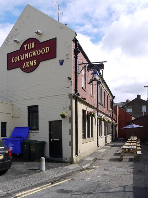
Image: © Andrew Curtis Taken: 9 Aug 2013
In the early 1800's Brandling Village was built for the employees of the Jesmond coal mines. The village consisted of two rows of terraced cottages either side of a now forgotten road called the High Street. A few years later, more substantial homes for the gentry were built on Brandling Park to the west and south. The Collingwood Arms was added to the east end of the High Street terraced cottages and opened its doors for the first time in 1836. The cottages are long gone but the 'High Street' is the road running from the gap through the Brandling Park houses at the east end of the village through to The Collingwood. Robert Hewlitt, the first landlord, had a great interest in naval history and so named the pub after the locally born Lord Collingwood (1750 – 1810) who was Commander in Chief of the British fleet in the Mediterranean and Nelson's second in command at the battle of Trafalgar Image There is a story that the pub was actually built in the shape of a ship's helm to play on this naval connection. The terraced miners' cottages and the original Brandling Arms, which stood in the middle of the terrace, were demolished in the 1930's but The Collingwood Arms remained. The Brandling Arms was then rebuilt on the same site as it's predecessor and the land between the two pubs has been a car park ever since. http://www.thecolly.co.uk/intro/
Images are licensed for reuse under creativecommons.org/licenses/by-sa/2.0
Image Location

Latitude
54.985088
Longitude
-1.608839