St Peter's Steps, Borough Road, North Shields
Introduction
The photograph on this page of St Peter's Steps, Borough Road, North Shields by Andrew Curtis as part of the Geograph project.
The Geograph project started in 2005 with the aim of publishing, organising and preserving representative images for every square kilometre of Great Britain, Ireland and the Isle of Man.

There are currently over 7.5m images from over 14,400 individuals and you can help contribute to the project by visiting https://www.geograph.org.uk
St Peter's Steps, Borough Road, North Shields
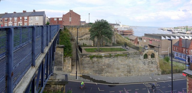
Image: © Andrew Curtis Taken: 28 Jul 2013
Cyclists are freewheeling down the steep bank of Borough Road below the footbridge Image heading for the Fish Quay or the Shields passenger ferry. St Peter's Steps on the far side of the road provide access to Yeoman Street alongside remains of the former church and school. St Peter's Church (the Sailors' Church) was built to serve the Low Town on the corner of Borough Road and Clive Street in 1862 with funds provided by the Duke of Northumberland. The church was demolished in 1936. http://www.tomorrows-history.com/public_item.php?collection=91&item=15083
Images are licensed for reuse under creativecommons.org/licenses/by-sa/2.0
Image Location
Latitude
55.004762
Longitude
-1.445426