Terrace of houses, Zion Place
Introduction
The photograph on this page of Terrace of houses, Zion Place by John Baker as part of the Geograph project.
The Geograph project started in 2005 with the aim of publishing, organising and preserving representative images for every square kilometre of Great Britain, Ireland and the Isle of Man.

There are currently over 7.5m images from over 14,400 individuals and you can help contribute to the project by visiting https://www.geograph.org.uk
Terrace of houses, Zion Place
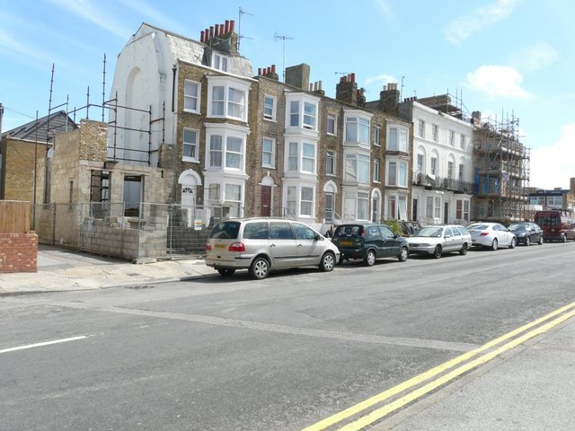
Image: © John Baker Taken: 28 Jul 2013
Number 6 is this end with scaffolding to its left. At the other end is number 12, which is the Avon Hotel; it is clad in scaffolding. Planning permission has been granted by Thanet District Council under application numbers L/TH/12/0617 for an “application for listed building consent for internal and external alterations including rebuilding of front elevation, replacement of front balcony and rear parapet” and F/TH/12/0746 for the “change of use from HMO to residential”.
Images are licensed for reuse under creativecommons.org/licenses/by-sa/2.0
Image Location
Latitude
51.391242
Longitude
1.388678