Halfway House
Introduction
The photograph on this page of Halfway House by Alan Murray-Rust as part of the Geograph project.
The Geograph project started in 2005 with the aim of publishing, organising and preserving representative images for every square kilometre of Great Britain, Ireland and the Isle of Man.

There are currently over 7.5m images from over 14,400 individuals and you can help contribute to the project by visiting https://www.geograph.org.uk
Halfway House
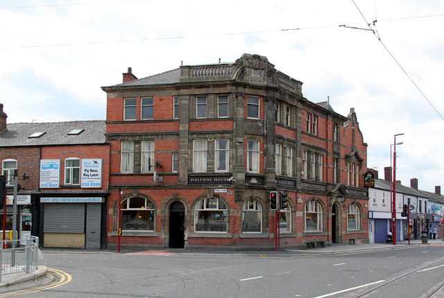
Image: © Alan Murray-Rust Taken: 7 Aug 2013
It's always fun to guess which two places a Halfway House refers to. In this case they are Manchester and Ashton-under-Lyne. Old OS maps show a milestone a little behind where I was standing with distances to Manchester of 3 miles and Ashton 2 3/4, so the pub itself is pretty well spot on.
Images are licensed for reuse under creativecommons.org/licenses/by-sa/2.0
Image Location
Latitude
53.480765
Longitude
-2.166767