Hartington Road, Southend
Introduction
The photograph on this page of Hartington Road, Southend by David Kemp as part of the Geograph project.
The Geograph project started in 2005 with the aim of publishing, organising and preserving representative images for every square kilometre of Great Britain, Ireland and the Isle of Man.

There are currently over 7.5m images from over 14,400 individuals and you can help contribute to the project by visiting https://www.geograph.org.uk
Hartington Road, Southend
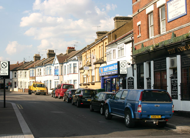
Image: © David Kemp Taken: 8 Aug 2013
The 'Cornucopia' can be seen on the right and the junction with Seaway on the left. Hartington Road is situated in a grid of terraced streets built in the second half of the C19 between the railway and what is now the Golden Mile. A century later the area was split into two when Queensway, a mini-urban freeway, was cut through it. Until the early 1950s, trolleybus services 52 and 52A used to turn up Hartington Road from the sea front and then turn immediately left into Seaway on a route linking Thorpe Bay and the Kursaal with various points in the town.
Images are licensed for reuse under creativecommons.org/licenses/by-sa/2.0
Image Location
Latitude
51.533587
Longitude
0.720864