The English Presbyterian Church of Wales, City Road, Chester
Introduction
The photograph on this page of The English Presbyterian Church of Wales, City Road, Chester by Bill Harrison as part of the Geograph project.
The Geograph project started in 2005 with the aim of publishing, organising and preserving representative images for every square kilometre of Great Britain, Ireland and the Isle of Man.

There are currently over 7.5m images from over 14,400 individuals and you can help contribute to the project by visiting https://www.geograph.org.uk
The English Presbyterian Church of Wales, City Road, Chester
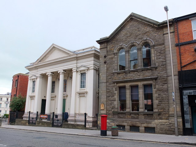
Image: © Bill Harrison Taken: 30 Jun 2013
Dating from 1864 and grade-II listed: http://www.britishlistedbuildings.co.uk/en-469728-english-presbyterian-church-of-wales- . To the right is the former chapel house (Sunday school), also grade-II listed: http://www.britishlistedbuildings.co.uk/en-469729-chapel-house-of-english-presbyterian-chu .
Images are licensed for reuse under creativecommons.org/licenses/by-sa/2.0
Image Location
Latitude
53.192943
Longitude
-2.882286