Navigating Hoole Lane Lock
Introduction
The photograph on this page of Navigating Hoole Lane Lock by Bill Harrison as part of the Geograph project.
The Geograph project started in 2005 with the aim of publishing, organising and preserving representative images for every square kilometre of Great Britain, Ireland and the Isle of Man.

There are currently over 7.5m images from over 14,400 individuals and you can help contribute to the project by visiting https://www.geograph.org.uk
Navigating Hoole Lane Lock
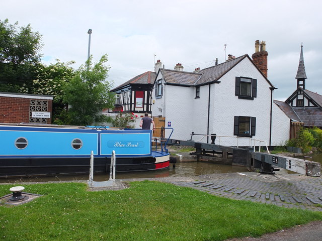
Image: © Bill Harrison Taken: 30 Jun 2013
The Blue Pearl has the upper gates closed behind it and waits for the lock to be emptied.
Images are licensed for reuse under creativecommons.org/licenses/by-sa/2.0
Image Location


Leaflet Map data © OpenStreetMap
Latitude
53.193726
Longitude
-2.87362