Hoole Lane Lock (Shropshire Union Canal)
Introduction
The photograph on this page of Hoole Lane Lock (Shropshire Union Canal) by Bill Harrison as part of the Geograph project.
The Geograph project started in 2005 with the aim of publishing, organising and preserving representative images for every square kilometre of Great Britain, Ireland and the Isle of Man.

There are currently over 7.5m images from over 14,400 individuals and you can help contribute to the project by visiting https://www.geograph.org.uk
Hoole Lane Lock (Shropshire Union Canal)
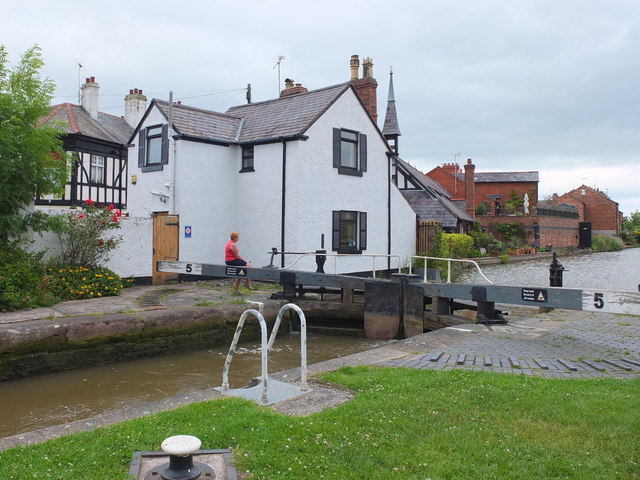
Image: © Bill Harrison Taken: 30 Jun 2013
This grade-II listed lock (http://www.britishlistedbuildings.co.uk/en-469719-hoole-lane-lock- ) dates from the very early days of canals, just a few years after the Bridgewater Canal. The lady lock keeper perched on the balance beam wields her lock key (a large spanner), with which she had just opened the upper paddles (sluice gates).
Images are licensed for reuse under creativecommons.org/licenses/by-sa/2.0
Image Location
Latitude
53.193728
Longitude
-2.873321