New Marston, Oxford
Introduction
The photograph on this page of New Marston, Oxford by David Hallam-Jones as part of the Geograph project.
The Geograph project started in 2005 with the aim of publishing, organising and preserving representative images for every square kilometre of Great Britain, Ireland and the Isle of Man.

There are currently over 7.5m images from over 14,400 individuals and you can help contribute to the project by visiting https://www.geograph.org.uk
New Marston, Oxford
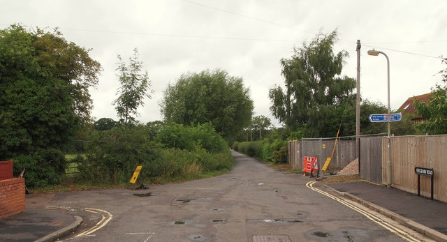
Image: © David Hallam-Jones Taken: 31 Jul 2013
From this crossroads at the northern end of Edgeway Road, cyclists and pedestrians who choose to turn left can get into the city (arriving near to Linacre College, St Cross Road) by joining the - University managed - "Mesopotamia Walk" (2-3 minutes away). The track ahead leads to Park Farm and on towards sports fields owned by Exeter and St Catherine's Colleges, whereas the track on the right, rendered impassable by security fencing, leads to Hertford College's sports ground. It occurs to me that rented accommodation would probably be slightly cheaper in this suburb and that some individuals might therefore choose to 'cycle in' from New Marston (10 minutes away), rather than living in the city centre?
Images are licensed for reuse under creativecommons.org/licenses/by-sa/2.0
Image Location
Latitude
51.761842
Longitude
-1.240996