Jacob's ladder
Introduction
The photograph on this page of Jacob's ladder by Hugh Craddock as part of the Geograph project.
The Geograph project started in 2005 with the aim of publishing, organising and preserving representative images for every square kilometre of Great Britain, Ireland and the Isle of Man.

There are currently over 7.5m images from over 14,400 individuals and you can help contribute to the project by visiting https://www.geograph.org.uk
Jacob's ladder
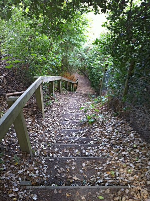
Image: © Hugh Craddock Taken: 4 Aug 2013
A steep and unexpectedly encountered flight of steps between Sandpitts Cottages and 4 Old Road, on public footpath Buckland 466, which runs between Old Road and bridleway 464 connecting with Wonham Lane. There has long been a footpath along this alignment, but (as the name of the neighbouring cottages suggest) a sandpit dug next to the former main road caused the footpath to be continued down the face of the sandpit by a stairway. The path endures today, although the sandpit has long since been parcelled up into residential plots.
Images are licensed for reuse under creativecommons.org/licenses/by-sa/2.0
Image Location
Latitude
51.239277
Longitude
-0.259772