
King's Mill Lane Area, Oxford
Introduction
The photograph on this page of King's Mill Lane Area, Oxford by David Hallam-Jones as part of the Geograph project.
The Geograph project started in 2005 with the aim of publishing, organising and preserving representative images for every square kilometre of Great Britain, Ireland and the Isle of Man.

There are currently over 7.5m images from over 14,400 individuals and you can help contribute to the project by visiting https://www.geograph.org.uk
King's Mill Lane Area, Oxford
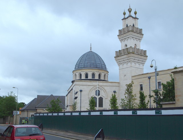
Image: © David Hallam-Jones Taken: 1 Aug 2013
The Oxford Centre for Islamic Studies (OCIS) at the city centre end of Marston Road (i.e. the B4150) seems still to be a work-in-progress. Workmen at the entrance to the site spoke about there being a September 2014 deadline for completion of the project. OCIS was established in 1985 with the aim of encouraging the academic study of Islam and the Muslim world. The centre's patron is Prince Charles. It is a "Recognised Independent Centre of the University of Oxford" and in the interim may already be functioning in temporary facilities elsewhere? Signs and railings at the rear of it seem to suggest that this complex may have been built on what was once part of Magdalen College's sport's field(s). London Place and St Clement's Street are a few yards ahead.
Images are licensed for reuse under creativecommons.org/licenses/by-sa/2.0
Image Location

Latitude
51.755784
Longitude
-1.235737