Riverside below North Shield Ferry Landing Stage
Introduction
The photograph on this page of Riverside below North Shield Ferry Landing Stage by Andrew Curtis as part of the Geograph project.
The Geograph project started in 2005 with the aim of publishing, organising and preserving representative images for every square kilometre of Great Britain, Ireland and the Isle of Man.

There are currently over 7.5m images from over 14,400 individuals and you can help contribute to the project by visiting https://www.geograph.org.uk
Riverside below North Shield Ferry Landing Stage
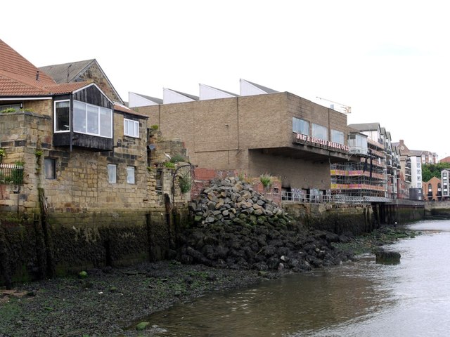
Image: © Andrew Curtis Taken: 28 Jul 2013
The stone-built riverside house with pantiled roof on the left was formerly a warehouse dating from the early C19th, now reduced to a single storey. Pastscape: http://www.pastscape.org.uk/hob.aspx?hob_id=955312 https://web.archive.org/web/20170221203141/https://www.pastscape.org.uk/hob.aspx?hob_id=955312 The modern building to the right was the former North East Rubber Comapany factory.
Images are licensed for reuse under creativecommons.org/licenses/by-sa/2.0
Image Location


Leaflet Map data © OpenStreetMap
Latitude
55.004756
Longitude
-1.444019