Risinghurst, Oxford
Introduction
The photograph on this page of Risinghurst, Oxford by David Hallam-Jones as part of the Geograph project.
The Geograph project started in 2005 with the aim of publishing, organising and preserving representative images for every square kilometre of Great Britain, Ireland and the Isle of Man.

There are currently over 7.5m images from over 14,400 individuals and you can help contribute to the project by visiting https://www.geograph.org.uk
Risinghurst, Oxford
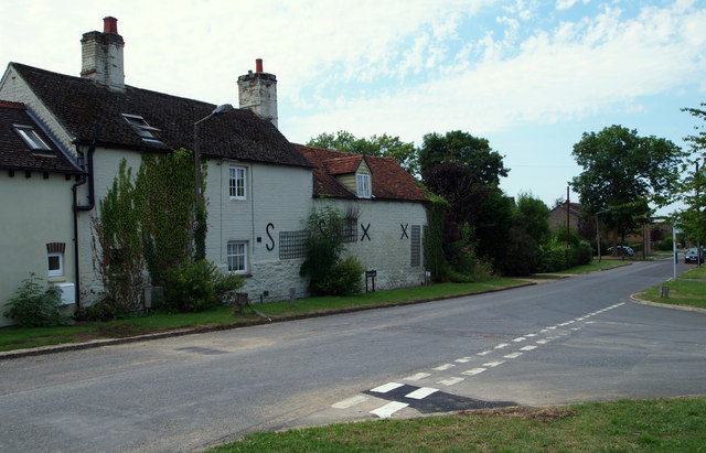
Image: © David Hallam-Jones Taken: 1 Aug 2013
A former farmhouse situated opposite Grovelands Road. This is a view of Kiln Lane looking towards where Kiln Lane joins the A4142, i.e. the Eastern By-Pass (2 minutes walk to the right). The parked car on the farmhouse side of the road marks the junction of Lewis Close, where C.S. Lewis' former home, The Kilns, is situated. Lewis' house was built in 1922 - by someone else - and therefore this property presumably pre-dates The Kilns? In the 1920-30s this area was entirely rural save for one or two isolated properties and the brick and tile works. Three of the latter were located off what is now known as Kiln Lane and they remained in operation until the early C20th.
Images are licensed for reuse under creativecommons.org/licenses/by-sa/2.0
Image Location
Latitude
51.757539
Longitude
-1.189055