Lindrick House
Introduction
The photograph on this page of Lindrick House by Neil Theasby as part of the Geograph project.
The Geograph project started in 2005 with the aim of publishing, organising and preserving representative images for every square kilometre of Great Britain, Ireland and the Isle of Man.

There are currently over 7.5m images from over 14,400 individuals and you can help contribute to the project by visiting https://www.geograph.org.uk
Lindrick House
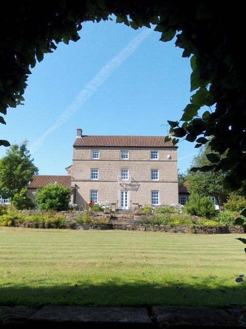
Image: © Neil Theasby Taken: 1 Aug 2013
Early 19th century Grade II listed building - "Deeply-coursed, squared limestone, pantile roof. 3 storeys, 3bays. Central French Window in ashlar door surround. All other bays with later iron casements in plain ashlar surrounds, the upper-floor windows linked by sill bands, the central 1st-floor window with iron-railed balcony.
Images are licensed for reuse under creativecommons.org/licenses/by-sa/2.0
Image Location
Latitude
53.340468
Longitude
-1.182329