Stevenson Square
Introduction
The photograph on this page of Stevenson Square by Gerald England as part of the Geograph project.
The Geograph project started in 2005 with the aim of publishing, organising and preserving representative images for every square kilometre of Great Britain, Ireland and the Isle of Man.

There are currently over 7.5m images from over 14,400 individuals and you can help contribute to the project by visiting https://www.geograph.org.uk
Stevenson Square
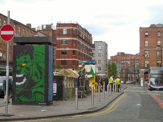
Image: © Gerald England Taken: 24 Jul 2013
With Oldham Street closed to buses due to a fire Image there are extra bus services using the square as their Manchester terminus. The roof of the old underground toilets on the right appears to be undergoing repairs. They are used now as a showcase for street artists with works being replaced roughly every three months. Update: The roof has been made into a little green garden. http://mancunianwave.blogspot.co.uk/2013/11/monday-mural-blank-spaces-on-stevenson.html
Images are licensed for reuse under creativecommons.org/licenses/by-sa/2.0
Image Location
Latitude
53.482271
Longitude
-2.233679