Signal box, Navigation Street, Birmingham
Introduction
The photograph on this page of Signal box, Navigation Street, Birmingham by Stephen Richards as part of the Geograph project.
The Geograph project started in 2005 with the aim of publishing, organising and preserving representative images for every square kilometre of Great Britain, Ireland and the Isle of Man.

There are currently over 7.5m images from over 14,400 individuals and you can help contribute to the project by visiting https://www.geograph.org.uk
Signal box, Navigation Street, Birmingham
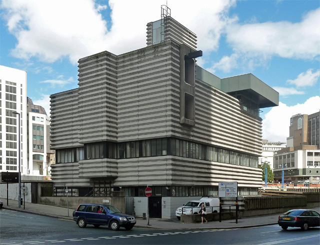
Image: © Stephen Richards Taken: 27 Aug 2011
An intriguing slice of Brutalism, by Bicknell & Hamilton with W.R. Headley of BR's London Midland Region, 1964-65. The Pevsner City Guide describes the surface as corrugated concrete. It certainly packs a punch.
Images are licensed for reuse under creativecommons.org/licenses/by-sa/2.0
Image Location
Latitude
52.477828
Longitude
-1.902635