OS benchmark - Haughton Road
Introduction
The photograph on this page of OS benchmark - Haughton Road by Richard Law as part of the Geograph project.
The Geograph project started in 2005 with the aim of publishing, organising and preserving representative images for every square kilometre of Great Britain, Ireland and the Isle of Man.

There are currently over 7.5m images from over 14,400 individuals and you can help contribute to the project by visiting https://www.geograph.org.uk
OS benchmark - Haughton Road
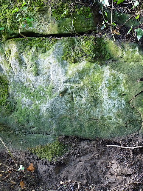
Image: © Richard Law Taken: 28 Jul 2013
A cutmark in the bedrock on the south side of the cutting, where Haughton Road climbs out of Shifnal near Haughton Mill house. I fully expected to find this had weathered badly, but was quite surprised to find it in good nick. Levelled at 99.4898m, 326'5" above Ordnance Datum Newlyn.
Images are licensed for reuse under creativecommons.org/licenses/by-sa/2.0
Image Location


Leaflet Map data © OpenStreetMap
Latitude
52.675837
Longitude
-2.384642