Birchwood Lane on Arbrook Common
Introduction
The photograph on this page of Birchwood Lane on Arbrook Common by Hugh Craddock as part of the Geograph project.
The Geograph project started in 2005 with the aim of publishing, organising and preserving representative images for every square kilometre of Great Britain, Ireland and the Isle of Man.

There are currently over 7.5m images from over 14,400 individuals and you can help contribute to the project by visiting https://www.geograph.org.uk
Birchwood Lane on Arbrook Common
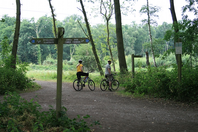
Image: © Hugh Craddock Taken: 21 Jul 2013
Junction of Birchwood Lane, carrying public bridleway Esher 46, and public footpaths Esher 37 and 37a, on Arbrook Common. In the foreground is a guidepost, signing the public bridleway (left, Birchwood Lane, to Claygate) and horse ride (right, to Esher Common). The continuation of the public bridleway is a little further ahead on the right, where the cyclists have paused, and also signed with a fingerpost. On the right is displayed the byelaws made by Elmbridge Borough Council in relation to Arbrook and the neighbouring Esher commons.
Images are licensed for reuse under creativecommons.org/licenses/by-sa/2.0
Image Location
Latitude
51.352929
Longitude
-0.357119