Oldham's level crossing
Introduction
The photograph on this page of Oldham's level crossing by Peter Whatley as part of the Geograph project.
The Geograph project started in 2005 with the aim of publishing, organising and preserving representative images for every square kilometre of Great Britain, Ireland and the Isle of Man.

There are currently over 7.5m images from over 14,400 individuals and you can help contribute to the project by visiting https://www.geograph.org.uk
Oldham's level crossing
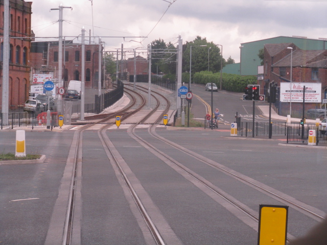
Image: © Peter Whatley Taken: 24 Jul 2013
As part of the downgrading of the Manchester-Oldham-Rochdale railway to a tramway, the railway bridge carrying trains clear of the main road junctions on the eastern edge of town was demolished. Trams must now cross the point at which four major roads converge by this level crossing until a street running section through Oldham is established in either 2013/14, depending on how late the Metrolink project is running by that stage. The point ahead shows where the street-running section will diverge. Whichever route is in use, journey times beyond Oldham are notably slower than by train.
Images are licensed for reuse under creativecommons.org/licenses/by-sa/2.0
Image Location
Latitude
53.542949
Longitude
-2.101218