Spring Lane, Colne, Lancashire
Introduction
The photograph on this page of Spring Lane, Colne, Lancashire by Dr Neil Clifton as part of the Geograph project.
The Geograph project started in 2005 with the aim of publishing, organising and preserving representative images for every square kilometre of Great Britain, Ireland and the Isle of Man.

There are currently over 7.5m images from over 14,400 individuals and you can help contribute to the project by visiting https://www.geograph.org.uk
Spring Lane, Colne, Lancashire
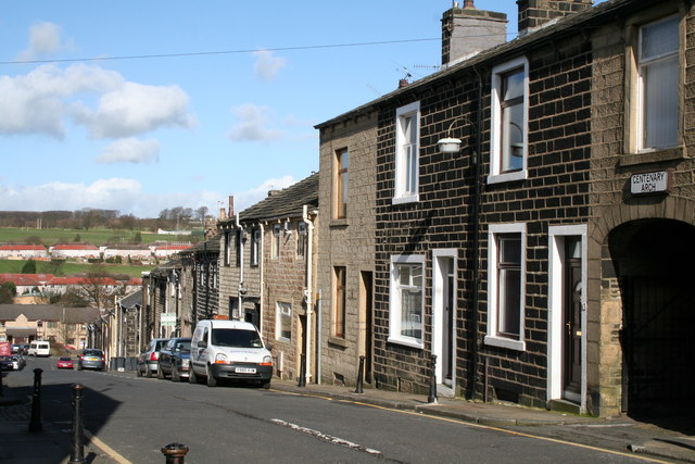
Image: © Dr Neil Clifton Taken: 6 Mar 2007
Spring Lane runs down steeply to the north from Albert Road to join the North Valley road at a roundabout. These houses on the right hand side of Spring Lane are of interest, as they are genuine back-to-back houses, a type once built in their tens of thousands in the great industrial cities of the north and Midlands, but now almost extinct. There are a few survivors in Barnoldswick also. For a map showing the Spring Lane houses, see http://mario.lancashire.gov.uk/viewer.htm?layeron=Schools&legend=yes&categ=Education&point=389096:440476:5000
Images are licensed for reuse under creativecommons.org/licenses/by-sa/2.0
Image Location


Leaflet Map data © OpenStreetMap
Latitude
53.856551
Longitude
-2.173733