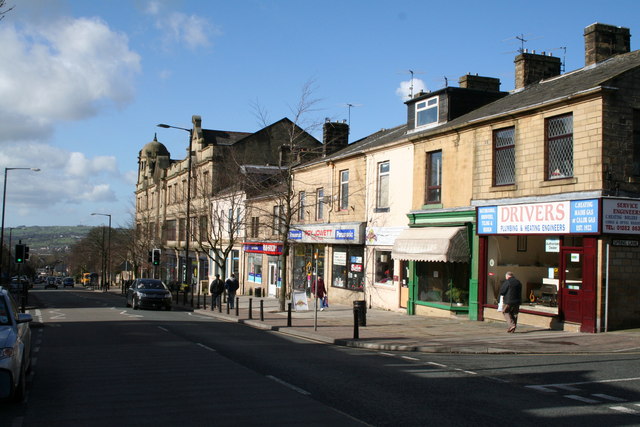
Albert Road and Municipal Hall, Colne, Lancashire
Introduction
The photograph on this page of Albert Road and Municipal Hall, Colne, Lancashire by Dr Neil Clifton as part of the Geograph project.
The Geograph project started in 2005 with the aim of publishing, organising and preserving representative images for every square kilometre of Great Britain, Ireland and the Isle of Man.
There are currently over 7.5m images from over 14,400 individuals and you can help contribute to the project by visiting https://www.geograph.org.uk

Image: © Dr Neil Clifton Taken: 6 Mar 2007
This shows the eastern end of Albert Road. Just beyond the furthermost building is the Municipal Hall, (not visible here as it is set back from the road) which still fulfils its original purpose as a concert hall and hosts a variety of events throughout the year. The large building with the domed tower, seen at the bottom of the block is the former Co-op building. This co-op building took over from the older building at Shackleton Hall as the main Co-op department store for the town. It now has small shop units on the ground floor, with residential flats on the upper floors.

