Shanklin United Reformed Church, Shanklin High Street
Introduction
The photograph on this page of Shanklin United Reformed Church, Shanklin High Street by David Dixon as part of the Geograph project.
The Geograph project started in 2005 with the aim of publishing, organising and preserving representative images for every square kilometre of Great Britain, Ireland and the Isle of Man.

There are currently over 7.5m images from over 14,400 individuals and you can help contribute to the project by visiting https://www.geograph.org.uk
Shanklin United Reformed Church, Shanklin High Street
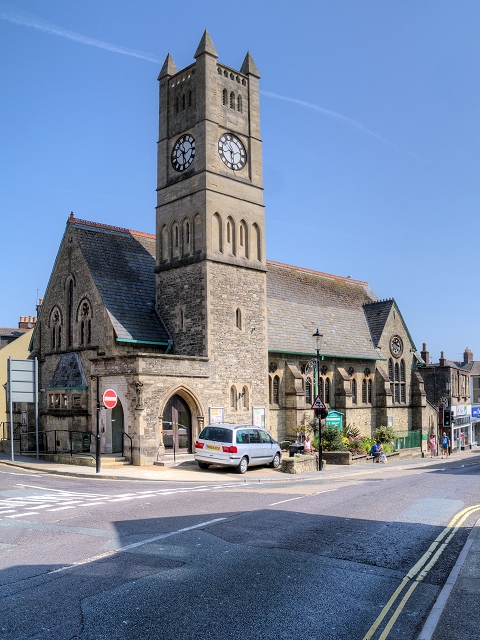
Image: © David Dixon Taken: 17 Jul 2013
The United Reformed Church (previously the Congregational Church) on Shanklin High Street. the church was rebuilt after being destroyed by bombing during World War II
Images are licensed for reuse under creativecommons.org/licenses/by-sa/2.0
Image Location
Latitude
50.629405
Longitude
-1.178781