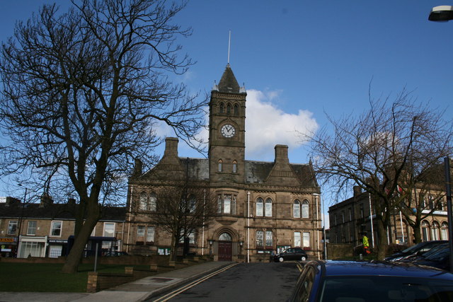
Town Hall, Colne, Lancashire
Introduction
The photograph on this page of Town Hall, Colne, Lancashire by Dr Neil Clifton as part of the Geograph project.
The Geograph project started in 2005 with the aim of publishing, organising and preserving representative images for every square kilometre of Great Britain, Ireland and the Isle of Man.
There are currently over 7.5m images from over 14,400 individuals and you can help contribute to the project by visiting https://www.geograph.org.uk

Image: © Dr Neil Clifton Taken: 6 Mar 2007
Colne is a very old town, which was granted the status of Municipal Borough many years ago. A progressive and positive attitude was always shown by the council: the town even had its own electric trams, as well as this fine Town Hall. But in the ill-advised local government reorganisation of 1974, Colne lost its autonomy and became part of the Borough of Pendle, which included not only the larger but much newer town of Nelson to the west, but also the small Yorkshire towns of Barnoldswick and Earby to the North.

