Radcliffe-on-Trent, Notts.
Introduction
The photograph on this page of Radcliffe-on-Trent, Notts. by David Hallam-Jones as part of the Geograph project.
The Geograph project started in 2005 with the aim of publishing, organising and preserving representative images for every square kilometre of Great Britain, Ireland and the Isle of Man.

There are currently over 7.5m images from over 14,400 individuals and you can help contribute to the project by visiting https://www.geograph.org.uk
Radcliffe-on-Trent, Notts.
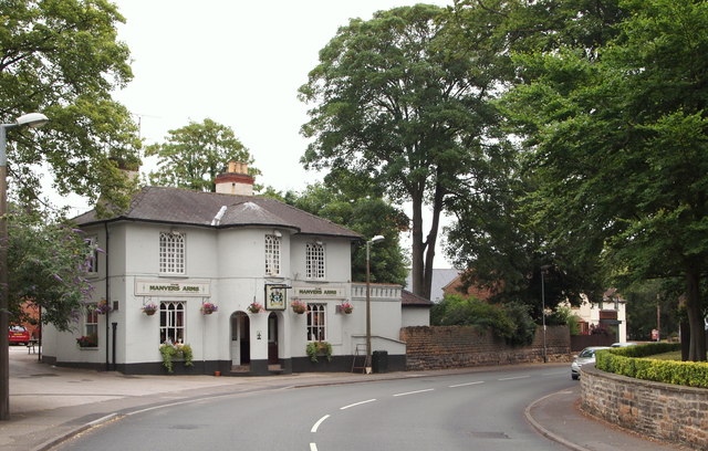
Image: © David Hallam-Jones Taken: 20 Jul 2013
Originally called The White Hart, the Grade II-listed "Manvers Arms" pub sits opposite St Mary's Church on Main Street. This is the view seen by individuals entering Radcliffe from Nottingham Road (a 'B' road) that has branched off the A62 (Gamston area). Each succeeding member of the aristocratic Manvers family was the owner of nearly all the local land, the lord of the manor and the patron of the St Mary's Church 'living'.
Images are licensed for reuse under creativecommons.org/licenses/by-sa/2.0
Image Location
Latitude
52.946774
Longitude
-1.042284