Auchagallon Cairn
Introduction
The photograph on this page of Auchagallon Cairn by David Baird as part of the Geograph project.
The Geograph project started in 2005 with the aim of publishing, organising and preserving representative images for every square kilometre of Great Britain, Ireland and the Isle of Man.

There are currently over 7.5m images from over 14,400 individuals and you can help contribute to the project by visiting https://www.geograph.org.uk
Auchagallon Cairn
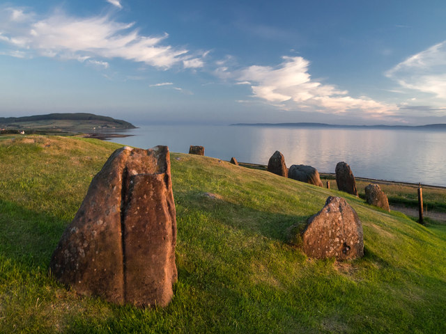
Image: © David Baird Taken: 8 Jul 2013
A late neolithic/early bronze age monument similar to this one on Machrie Moor: http://www.geograph.org.uk/photo/3557148, and with similar uncertainty as to whether it is a stone circle, or a burial cairn with large kerb stones.
Images are licensed for reuse under creativecommons.org/licenses/by-sa/2.0
Image Location
Latitude
55.559773
Longitude
-5.342774