Site of Garneddwen station
Introduction
The photograph on this page of Site of Garneddwen station by Ben Brooksbank as part of the Geograph project.
The Geograph project started in 2005 with the aim of publishing, organising and preserving representative images for every square kilometre of Great Britain, Ireland and the Isle of Man.

There are currently over 7.5m images from over 14,400 individuals and you can help contribute to the project by visiting https://www.geograph.org.uk
Site of Garneddwen station
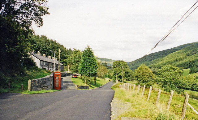
Image: © Ben Brooksbank Taken: 12 Sep 1999
View NE up the Afon Dulas valley, towards Aberllefeni. Until closed from 21/8/48 (passengers from 1/1/31), the narrow-gauge Corris Railway on its way from Machynlleth to Aberllefeni ran parallel to the road and crossed it here, but it is uncertain whether Garneddwen station was on the left or right. (Update August 2020 - The 1901 OS 1:2,500 scale map shows that the station buildings, such as they were, were located on the left side of the railway and road here. The map also shows that the railway passed immediately to the right of the front garden walls, along what is now the road with the red car.)
Images are licensed for reuse under creativecommons.org/licenses/by-sa/2.0
Image Location
Latitude
52.662411
Longitude
-3.829871