Beverley, HU17
Introduction
The photograph on this page of Beverley, HU17 by David Hallam-Jones as part of the Geograph project.
The Geograph project started in 2005 with the aim of publishing, organising and preserving representative images for every square kilometre of Great Britain, Ireland and the Isle of Man.

There are currently over 7.5m images from over 14,400 individuals and you can help contribute to the project by visiting https://www.geograph.org.uk
Beverley, HU17
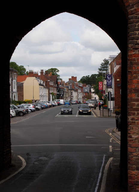
Image: © David Hallam-Jones Taken: 4 Jul 2013
The view of the A164 (North-Bar-Without) through The North Bar arch. This is the town’s last surviving medieval gate, dated to 1409. The town's gates were not part of a walled defensive system but were designed to assist in raising and collecting taxes. This was the principal gate and it is unique in being the only brick-built town gate in the country. This was a result of the East Riding lacking a ready supply of local building stone. Stone, timber and a variety of other raw materials were eventually imported via the River Hull and Beverley Beck, although of course this particular canal was not constructed until the early C19th.
Images are licensed for reuse under creativecommons.org/licenses/by-sa/2.0
Image Location
Latitude
53.844869
Longitude
-0.435955