Beal Farm, Chudleigh Knighton
Introduction
The photograph on this page of Beal Farm, Chudleigh Knighton by David Smith as part of the Geograph project.
The Geograph project started in 2005 with the aim of publishing, organising and preserving representative images for every square kilometre of Great Britain, Ireland and the Isle of Man.

There are currently over 7.5m images from over 14,400 individuals and you can help contribute to the project by visiting https://www.geograph.org.uk
Beal Farm, Chudleigh Knighton
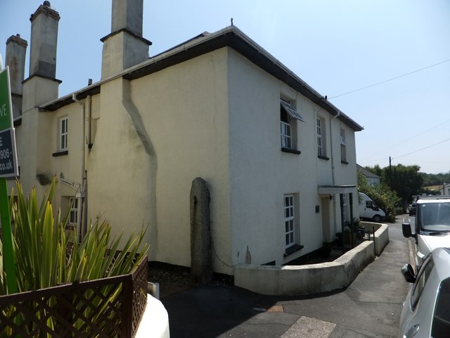
Image: © David Smith Taken: 12 Jul 2013
A former farmhouse on the main road through the village. On the side wall is a granite gatepost, and a road gives access to the recent development of Beal Farm Mews. The farmhouse porch is supported on two unusual long barley-sugar twist uprights.
Images are licensed for reuse under creativecommons.org/licenses/by-sa/2.0
Image Location
Latitude
50.584888
Longitude
-3.632004