View of The Broadwater
Introduction
The photograph on this page of View of The Broadwater by Robert Ashby as part of the Geograph project.
The Geograph project started in 2005 with the aim of publishing, organising and preserving representative images for every square kilometre of Great Britain, Ireland and the Isle of Man.

There are currently over 7.5m images from over 14,400 individuals and you can help contribute to the project by visiting https://www.geograph.org.uk
View of The Broadwater
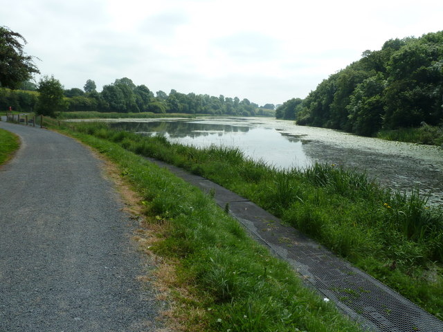
Image: © Robert Ashby Taken: 10 Jul 2013
Looking along The Broadwater towards Moira. The narrow mesh walkway is for angling. The Broadwater is a man-made feature dug in a natural valley to provide a sufficient of head of water to accommodate the navigation of the canal. Moira is said to be the only town in Ireland to straddle two counties, Co Armagh and Co Down, but as the River Lagan forms the border between Co Down and Co Antrim between Belfast and Lisburn both of these could also claim to do that.
Images are licensed for reuse under creativecommons.org/licenses/by-sa/2.0
Image Location
Latitude
54.510057
Longitude
-6.240842