Former "Woodsides", Carrickfergus
Introduction
The photograph on this page of Former "Woodsides", Carrickfergus by Albert Bridge as part of the Geograph project.
The Geograph project started in 2005 with the aim of publishing, organising and preserving representative images for every square kilometre of Great Britain, Ireland and the Isle of Man.

There are currently over 7.5m images from over 14,400 individuals and you can help contribute to the project by visiting https://www.geograph.org.uk
Former "Woodsides", Carrickfergus
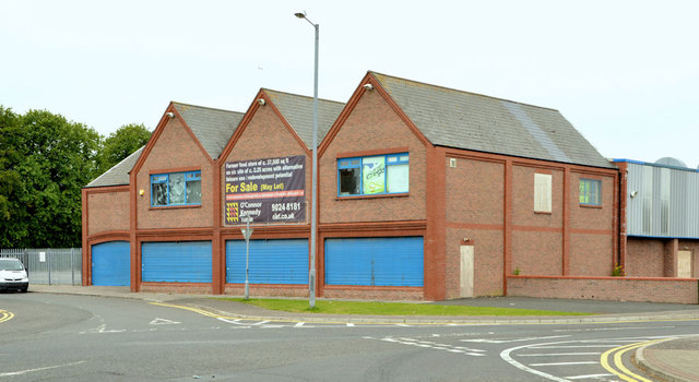
Image: © Albert Bridge Taken: 10 Jul 2013
Now long-closed, the former “Woodsides” at 30 Joymount is offered for sale on behalf of an insolvency practitioner. To the best of my knowledge this was the biggest of the six branches and incorporated a supermarket in addition to the usual clothes, hardware and “fancy goods”.
Images are licensed for reuse under creativecommons.org/licenses/by-sa/2.0
Image Location
Latitude
54.717269
Longitude
-5.802438