Disused building near Lower Farm south of Bedwellty Pits
Introduction
The photograph on this page of Disused building near Lower Farm south of Bedwellty Pits by Jaggery as part of the Geograph project.
The Geograph project started in 2005 with the aim of publishing, organising and preserving representative images for every square kilometre of Great Britain, Ireland and the Isle of Man.

There are currently over 7.5m images from over 14,400 individuals and you can help contribute to the project by visiting https://www.geograph.org.uk
Disused building near Lower Farm south of Bedwellty Pits
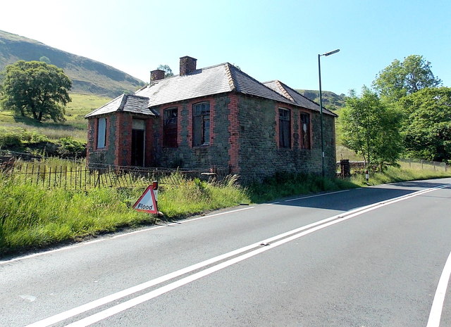
Image: © Jaggery Taken: 6 Jul 2013
The building of unknown previous use is on the west side of the A4048, opposite Lower Farm. The temporary triangular sign showing Flood has presumably been left here for some time. This view was taken during a dry and sunny period of weather. There had been no heavy rain for at least a month previously.
Images are licensed for reuse under creativecommons.org/licenses/by-sa/2.0
Image Location
Latitude
51.742464
Longitude
-3.22264