Picnic area, Killucan
Introduction
The photograph on this page of Picnic area, Killucan by Kenneth Allen as part of the Geograph project.
The Geograph project started in 2005 with the aim of publishing, organising and preserving representative images for every square kilometre of Great Britain, Ireland and the Isle of Man.

There are currently over 7.5m images from over 14,400 individuals and you can help contribute to the project by visiting https://www.geograph.org.uk
Picnic area, Killucan
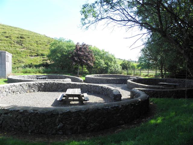
Image: © Kenneth Allen Taken: 9 Jul 2013
They have circular compartments round the picnic tables, possibly copying the stone circles at Beaghmore? Not the best of images but hopefully it illustrates the conception.
Images are licensed for reuse under creativecommons.org/licenses/by-sa/2.0
Image Location
Latitude
54.667349
Longitude
-6.931061