Church and village boundary, Crickadarn
Introduction
The photograph on this page of Church and village boundary, Crickadarn by Jaggery as part of the Geograph project.
The Geograph project started in 2005 with the aim of publishing, organising and preserving representative images for every square kilometre of Great Britain, Ireland and the Isle of Man.

There are currently over 7.5m images from over 14,400 individuals and you can help contribute to the project by visiting https://www.geograph.org.uk
Church and village boundary, Crickadarn
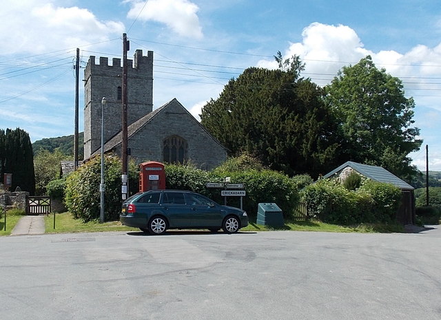
Image: © Jaggery Taken: 7 Jul 2013
Viewed looking towards the castellated tower of St Mary's Church The Crickadarn village boundary sign faces the road from Erwood. The signpost arm pointing left shows 4 miles to Llaneglwys. The arm pointing right shows 2 miles to Gwenddwr. The arm pointing towards the camera shows ¾ mile to Erwood.
Images are licensed for reuse under creativecommons.org/licenses/by-sa/2.0
Image Location
Latitude
52.070834
Longitude
-3.329929