Ordnance Survey Flush Bracket (905)
Introduction
The photograph on this page of Ordnance Survey Flush Bracket (905) by Adrian Dust as part of the Geograph project.
The Geograph project started in 2005 with the aim of publishing, organising and preserving representative images for every square kilometre of Great Britain, Ireland and the Isle of Man.

There are currently over 7.5m images from over 14,400 individuals and you can help contribute to the project by visiting https://www.geograph.org.uk
Ordnance Survey Flush Bracket (905)
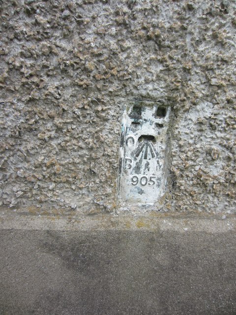
Image: © Adrian Dust Taken: 2 Jun 2013
This OS Flush Bracket (905) can be found on the front of a cottage at Wern-ystrad-Maerig. It was used during the Second Geodetic Levelling of England & Wales (1912-21) Carmarthen - Llandovery Levelling Line. Also the Third Geodetic Levelling of England & Wales (1950-68) Llandovery - Carmarthen Levelling Line. It marks a point 171.9950ft above mean sea level.
Images are licensed for reuse under creativecommons.org/licenses/by-sa/2.0
Image Location
Latitude
51.939918
Longitude
-3.866511