Sheepcombe, Coombe Rise, Findon Valley
Introduction
The photograph on this page of Sheepcombe, Coombe Rise, Findon Valley by Simon Carey as part of the Geograph project.
The Geograph project started in 2005 with the aim of publishing, organising and preserving representative images for every square kilometre of Great Britain, Ireland and the Isle of Man.

There are currently over 7.5m images from over 14,400 individuals and you can help contribute to the project by visiting https://www.geograph.org.uk
Sheepcombe, Coombe Rise, Findon Valley
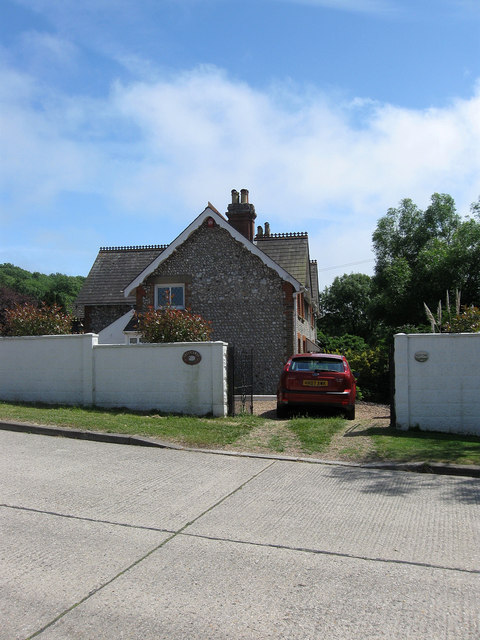
Image: © Simon Carey Taken: 30 Jun 2013
The flint buildings date from the late 19th century and until the 1930s were one of the few dwellings in what was to become Findon Valley. A manor house existed in the 17th century which had become two tenements by the 19th which were replaced by the current building as two cottages which were later knocked into one. Much of the former farm land was transferred to Worthing in 1933 after which the suburb was developed. The house lies towards the eastern end of Coombe Rise. Two other farm buildings out of shot to the right have also been converted into residences.
Images are licensed for reuse under creativecommons.org/licenses/by-sa/2.0
Image Location
Latitude
50.847748
Longitude
-0.392117