Charles Edward Brooke School: detail of tower
Introduction
The photograph on this page of Charles Edward Brooke School: detail of tower by Robin Stott as part of the Geograph project.
The Geograph project started in 2005 with the aim of publishing, organising and preserving representative images for every square kilometre of Great Britain, Ireland and the Isle of Man.

There are currently over 7.5m images from over 14,400 individuals and you can help contribute to the project by visiting https://www.geograph.org.uk
Charles Edward Brooke School: detail of tower
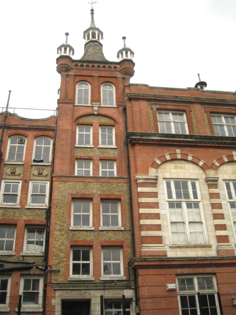
Image: © Robin Stott Taken: 23 Jun 2013
The 'six-storey' south tower of the original building with the girls' and infants' entrances at the bottom. The original building, built in 1897 for the London School Board, consisted of a 3-storey central block with a 6-storey tower on each side. It was extended in 1912. See Image After the First World War the Cormont Secondary School became the Kennington Boys School, an annexe of the Kennington Secondary School. Today, the building is Grade II listed and is the Charles Edward Brooke Girls' School, administered by the Church of England. Information from 'Lost Hospitals of London' http://www.ezitis.myzen.co.uk/firstlondon.html I am uncertain as to the present status of the school.
Images are licensed for reuse under creativecommons.org/licenses/by-sa/2.0
Image Location
Latitude
51.473419
Longitude
-0.106134