High Salvington Windmill
Introduction
The photograph on this page of High Salvington Windmill by Simon Carey as part of the Geograph project.
The Geograph project started in 2005 with the aim of publishing, organising and preserving representative images for every square kilometre of Great Britain, Ireland and the Isle of Man.

There are currently over 7.5m images from over 14,400 individuals and you can help contribute to the project by visiting https://www.geograph.org.uk
High Salvington Windmill
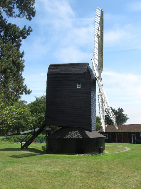
Image: © Simon Carey Taken: 30 Jun 2013
Located on Salvington Hill a mill has existed on this site as far back as the medieval period. The current post mill dates from around 1750 and remained in use until its closure in 1897 after which the roundhouse was used as a tearoom until the 1950s. The mill came into possession of Worthing Borough Council in 1959 and restoration work was applied over the following decades. The mill restarted grinding in 1991.
Images are licensed for reuse under creativecommons.org/licenses/by-sa/2.0
Image Location
Latitude
50.848576
Longitude
-0.406579