Barle Bridge, Dulverton
Introduction
The photograph on this page of Barle Bridge, Dulverton by Derek Harper as part of the Geograph project.
The Geograph project started in 2005 with the aim of publishing, organising and preserving representative images for every square kilometre of Great Britain, Ireland and the Isle of Man.

There are currently over 7.5m images from over 14,400 individuals and you can help contribute to the project by visiting https://www.geograph.org.uk
Barle Bridge, Dulverton
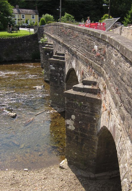
Image: © Derek Harper Taken: 26 Jun 2013
The downstream side of Image] http://www.britishlistedbuildings.co.uk/en-429309-barle-bridge-at-ngr-ss-9120-2782-dulvert from the other side of the river. Traffic, pedestrians, workmen and barriers make an awkward combination as work is carried out.
Images are licensed for reuse under creativecommons.org/licenses/by-sa/2.0
Image Location
Latitude
51.039313
Longitude
-3.553211